


Advances in China’s Ocean Satellite Observation System Since 2024
doi: 10.11728/cjss2026.04.2026-yg06 cstr: 32142.14.cjss.2026-yg06
-
Abstract: Since 2024, China’s ocean satellite program has made systematic progress in the construction of observation systems, expansion of mission portfolios, enhancement of ground-support capabilities, product development, and intelligent applications. An ocean satellite observation system composed of ocean color satellites, ocean dynamic satellites, and ocean surveillance and monitoring satellites has been initially established, providing multi-satellite coordinated observation capabilities over China’s coastal seas, the global ocean, and polar regions. The successful launch of HY-4A has filled a gap in China’s spaceborne ocean salinity observation capability and provided a foundational capacity for operational global ocean salinity monitoring and related scientific research. The stable operation of ground receiving systems, calibration and validation sites, and data-sharing infrastructure has provided reliable support for networked ocean satellite observations and operational applications. The upgrading of the ocean color satellite data processing system, the development of application-ready products for the Yellow Sea and East China Sea, and the generation of multi-parameter polar sea-ice products indicate that China’s ocean satellite product system is evolving from basic data provision toward thematic, refined, and operational applications. The development of artificial intelligence foundation models represented by “SkyOcean” further suggests that ocean satellite applications are extending from two-dimensional sea-surface observations toward three-dimensional environmental reconstruction and prediction services.
-
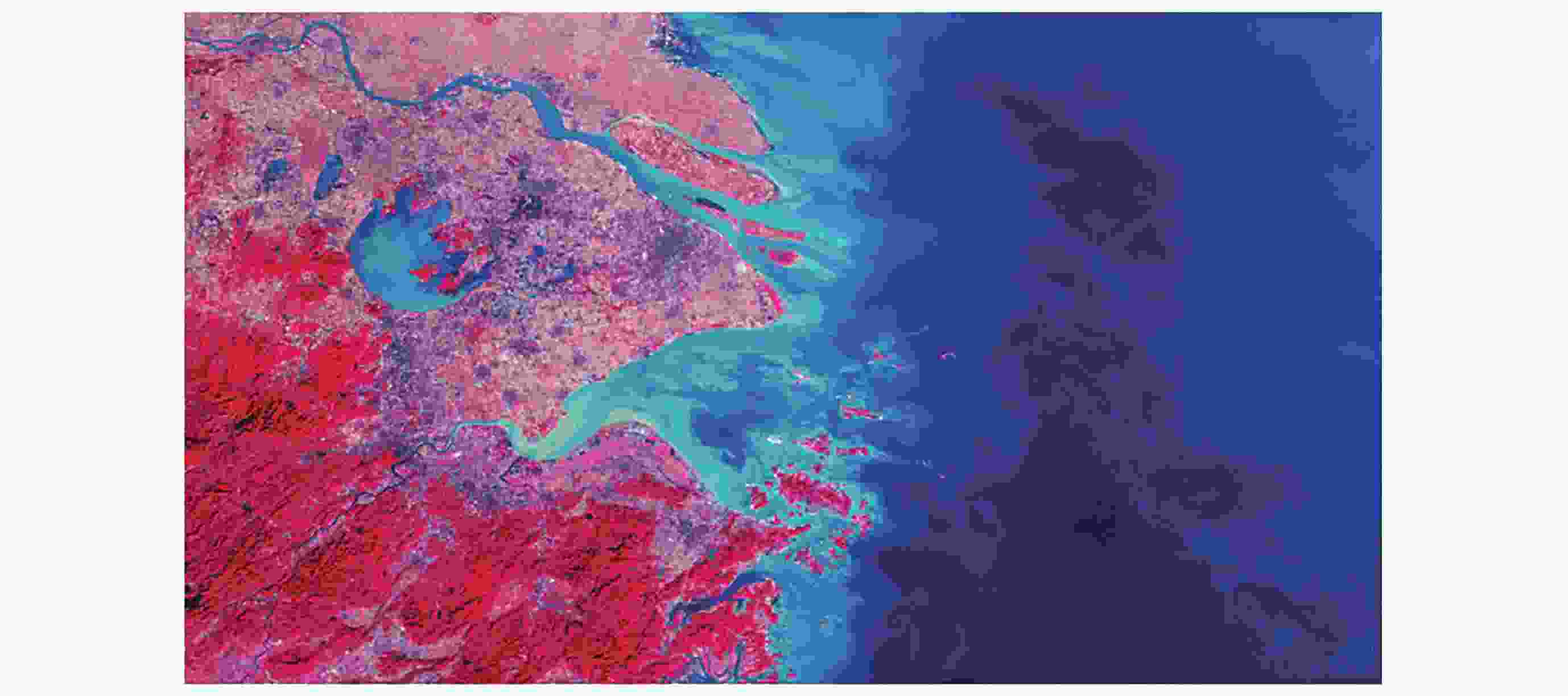
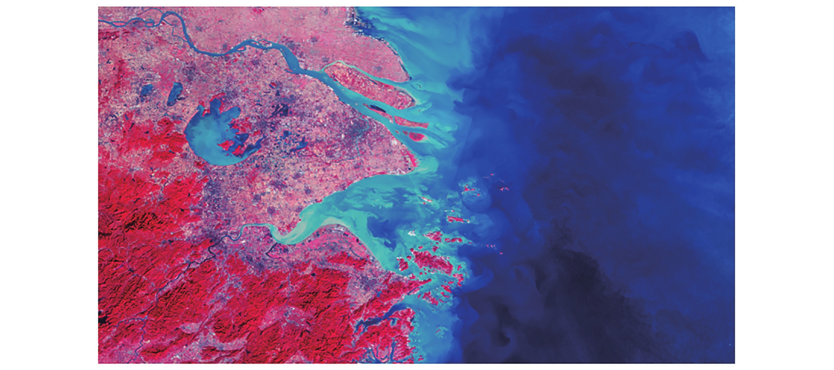
Figure 3. Local image example from the “China Ocean Color Satellite Yellow Sea and East China Sea Imagery and Remote Sensing Index Dataset”
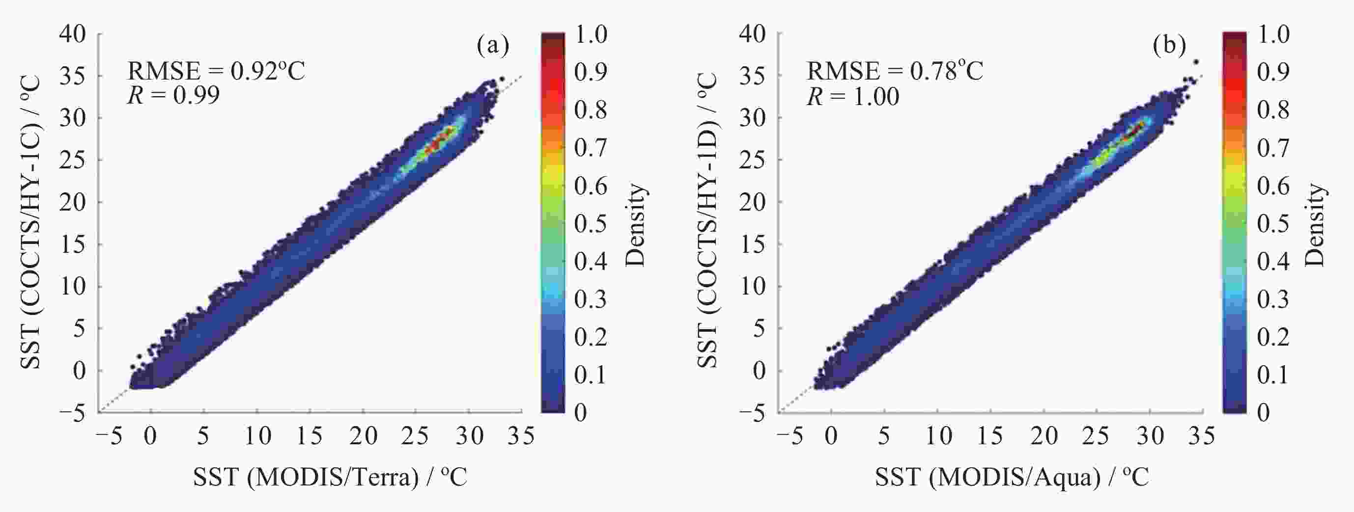
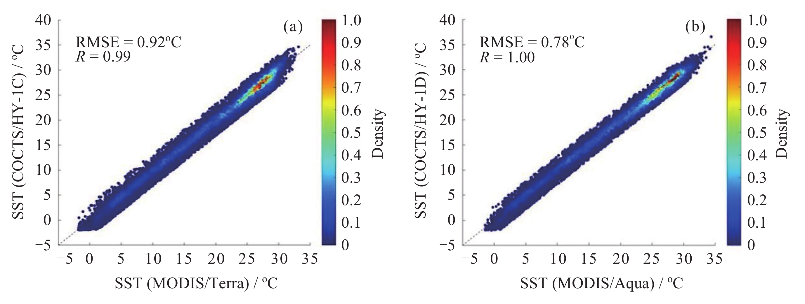
Figure 4. Consistency comparison between upgraded sea surface temperature daytime products from COCTS on HY-1C/D and corresponding MODIS products, using data from 20 June 2025 as an example. (a) HY-1C vs. Terra, (b) HY-1D vs. Aqua
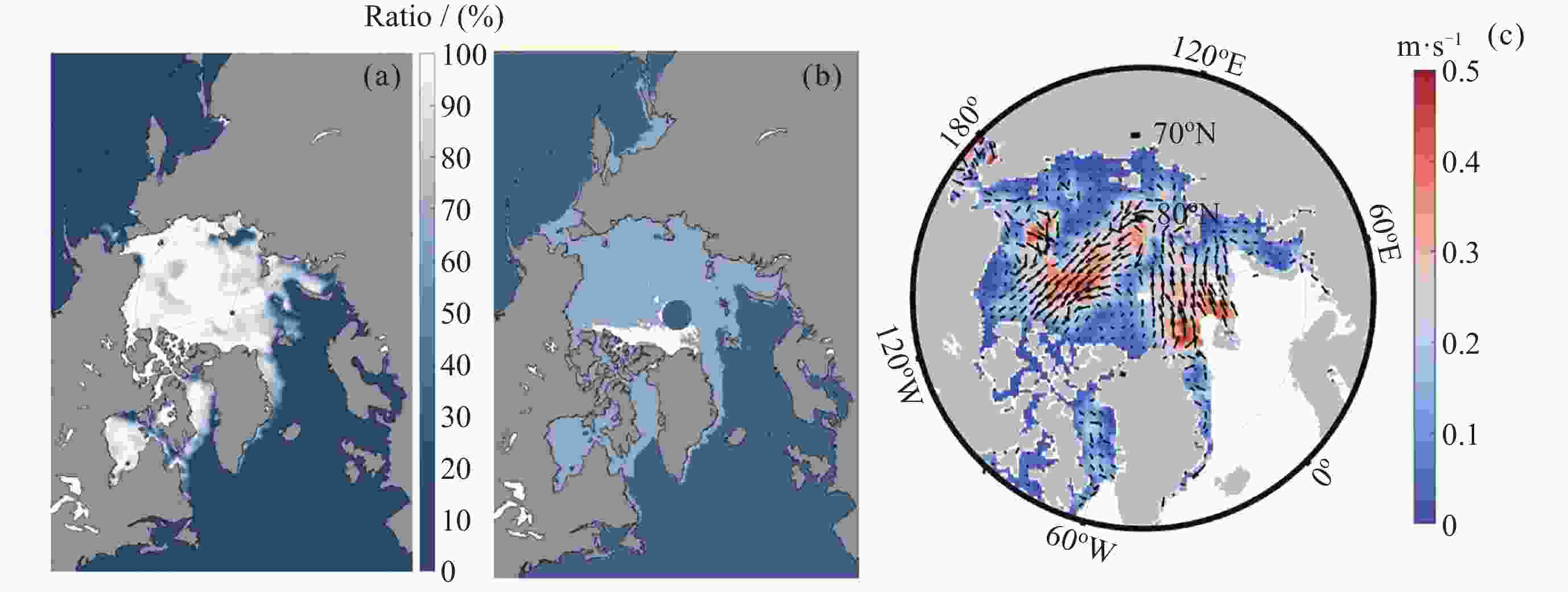
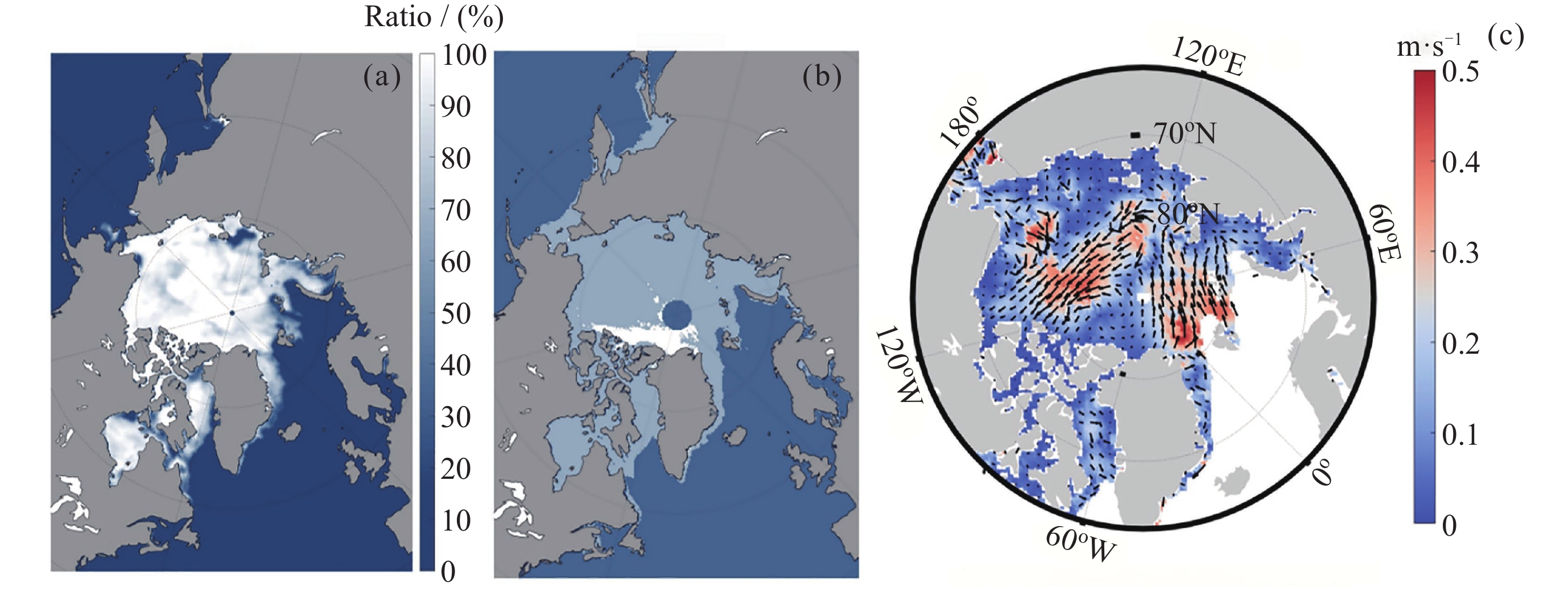
Figure 5. Schematic diagram of operational multi-parameter polar sea-ice products based on the active and passive microwave payloads of HY-2B ( Sea-ice concentration and sea-ice drift velocity)
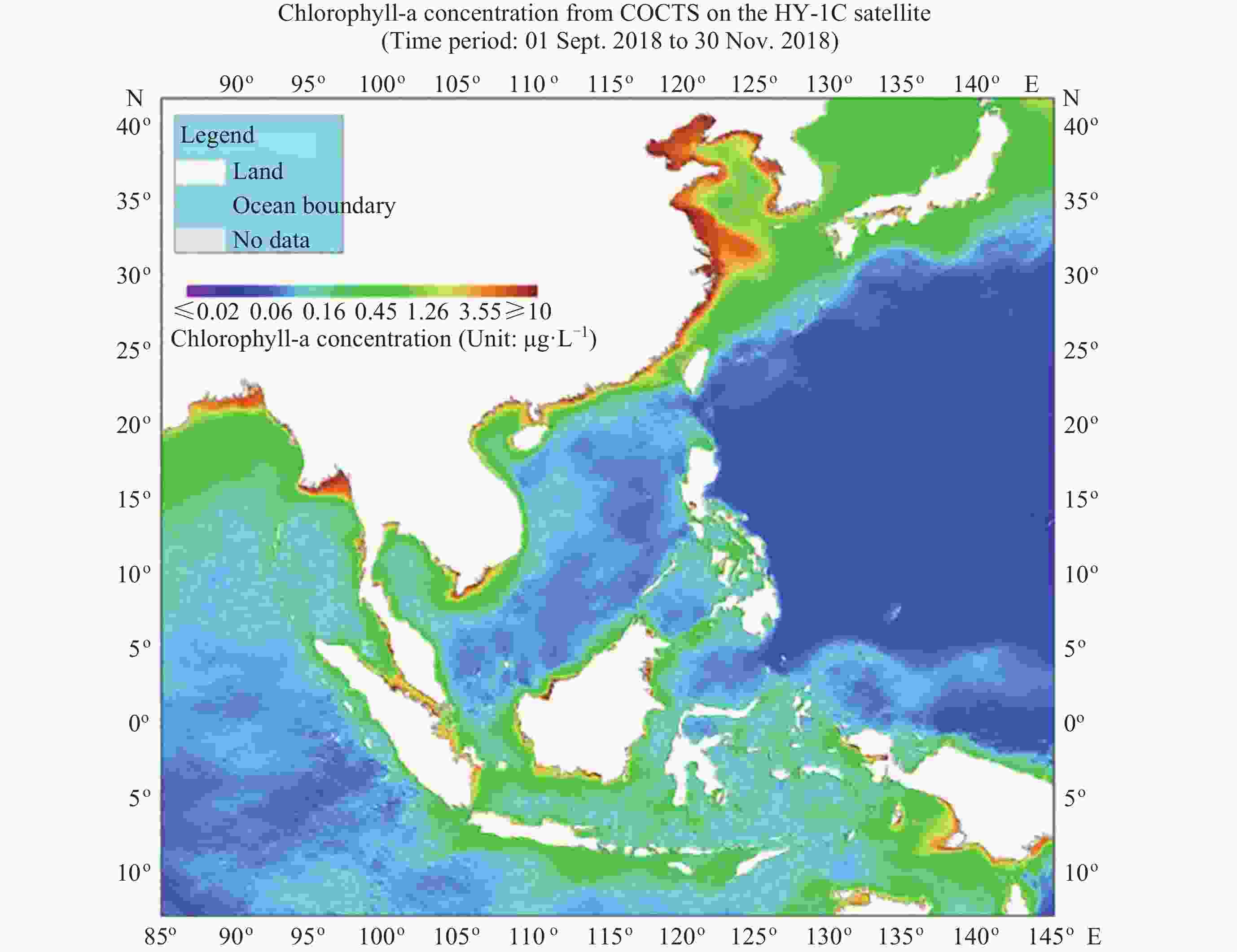
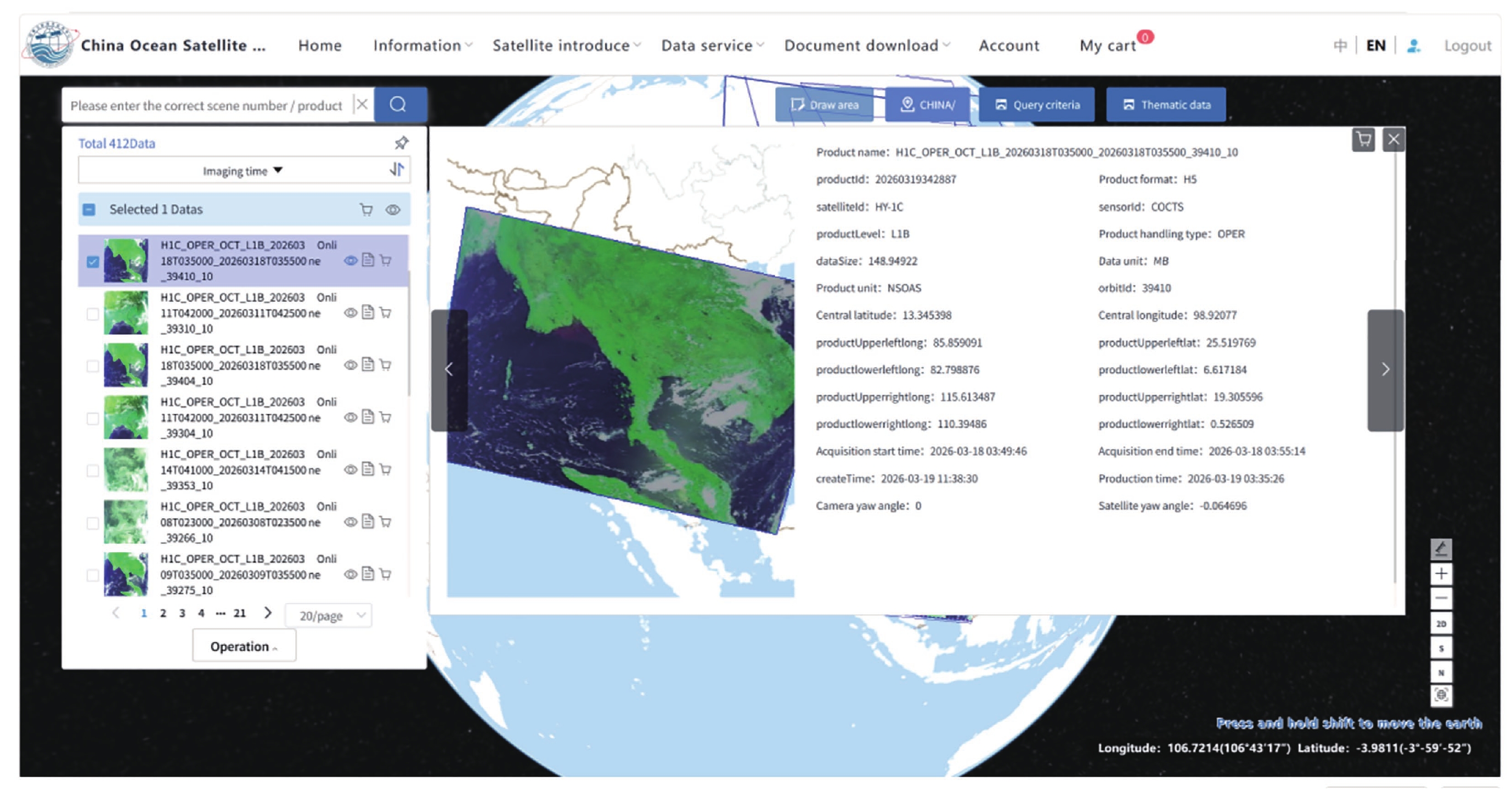
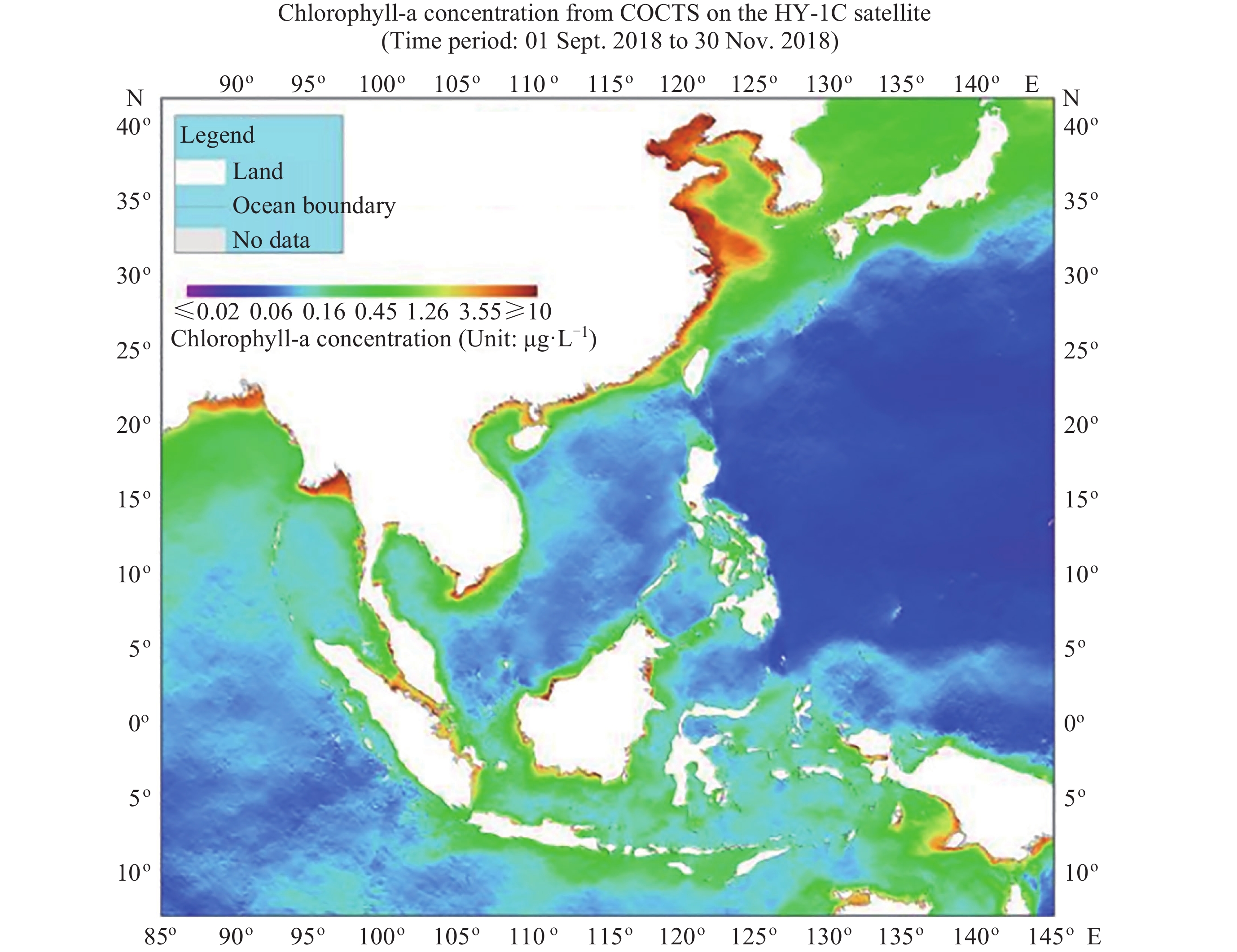
Figure 7. Example of chlorophyll-a concentration monitoring product for China-ASEAN sea areas
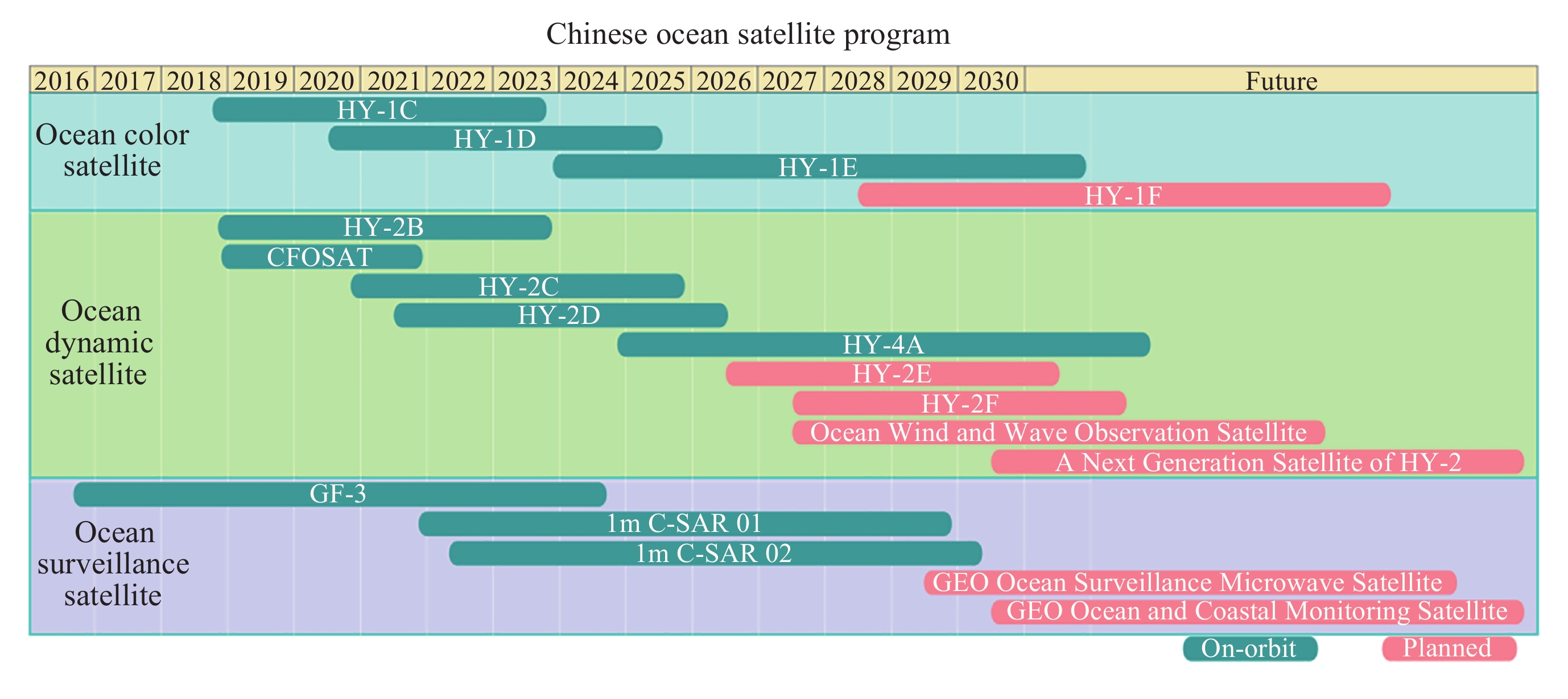
Table 1. Overview of China’s in-orbit ocean satellites
Category Representative satellites Main observation variables/applications Ocean color satellites HY-1C, HY-1D, HY-1E Sea surface temperature, ocean color, water optical parameters, marine ecological environment, and disaster monitoring Ocean dynamic satellites HY-2B, HY-2C, HY-2D, CFOSAT, HY-4A Sea surface wind field, sea surface height, ocean waves, sea surface salinity, sea surface temperature, etc. Ocean surveillance and monitoring satellites GF-3, 1 m C-SAR 01/02 Maritime target detection, refined coastal observations, sea-ice identification, wetland monitoring, etc. Note Products related to the CFOSAT scatterometer and the HY-2D microwave scatterometer have been discontinued because of payload antenna anomalies.  下载: 导出CSV
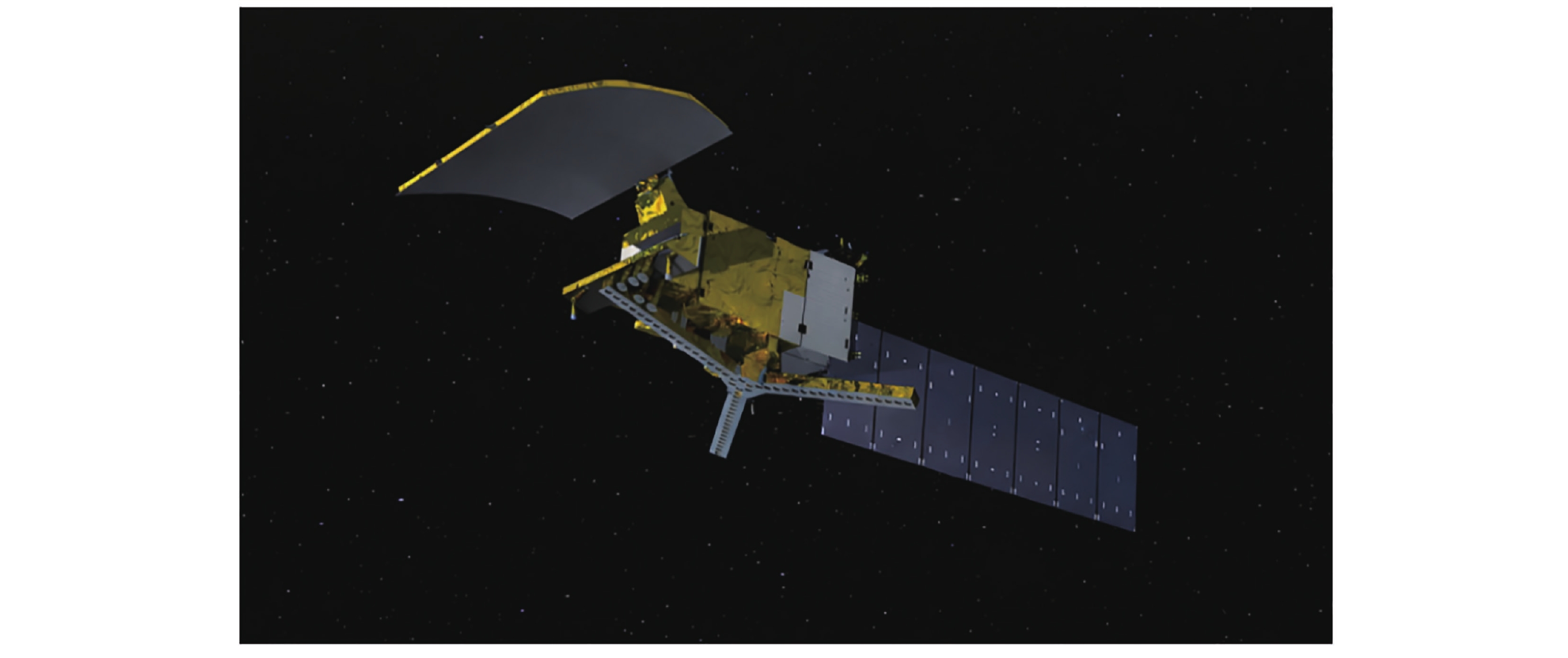
Table 2. Payloads and technical specifications of the Ocean Salinity Detection Satellite
Payload component Main function Technical specifications LASMR Acquires L-band sea-surface radiometric brightness temperature 1.400–1.427 GHz; 20 MHz; V/H/T3; sensitivity better than 1.5 K; stability better than 0.12 K; calibration accuracy 1.0 K; resolution better than 38 km; swath width better than 950 km MICAP: microwave radiometer, L band Provides brightness temperature detection and a stability reference 1.400–1.427 GHz; 25 MHz; V/H/T3; sensitivity better than 0.15 K; stability better than 0.12 K; resolution better than 75 km× 50 km; swath width better than 950 km MICAP: microwave radiometer, C band Provides environmental correction information 6.9 GHz; 200 MHz; V/H; sensitivity better than 0.5 K; stability better than 0.3 K; resolution better than 15 km× 25 km; swath width better than 950 km MICAP: microwave radiometer, K band Provides environmental correction information 18.7 GHz; 200 MHz; V/H; sensitivity better than 0.5 K; stability better than 0.3 K; resolution better than 15 km× 25 km; swath width better than 950 km MICAP: microwave scatterometer Acquires sea surface roughness and supports RFI detection and mitigation 1.25 GHz; HH/VV/HV/VH; bandwidth ≤5 MHz; peak power ≥200 W; calibration stability better than 0.1 dB; resolution 50–100 km; swath width better than 950 km
下载: 导出CSV
Table 3. Operational support system of ocean satellites
Application field Main observation requirements Main satellites/payloads Typical products Operational applications Marine ecological early-warning monitoring Ocean color, chlorophyll, floating algae, red tides, oil spills HY-1C/D/E, GF-3, 1 m C-SAR Chlorophyll, suspended sediment, floating algae index, oil spill identification products Monitoring of green tides caused by Ulva prolifera, red tides, Sargassum, and oil spills Marine disaster prevention and mitigation Sea surface wind field, ocean waves, sea ice, sea surface height HY-2B/C/D, CFOSAT, GF-3, 1 m C-SAR Wind field, ocean waves, sea level anomaly, sea-ice products Monitoring of typhoons, storm surges, and sea-ice disasters Global marine environmental monitoring Sea surface temperature, ocean color, sea surface height, sea surface salinity HY-1C/D/E, HY-2B/C/D, GF-3, 1 m C-SAR, CFOSAT, HY-4A Global marine environmental parameter products Research on climate change and air–sea interaction Polar monitoring Sea-ice extent, concentration, edge, and polar environment HY-1C/D/E, HY-2B, GF-3, 1 m C-SAR Multi-parameter polar sea-ice products Polar navigation and climate-change assessment Maritime safety and resource management Vessels, maritime targets, wetlands, shorelines GF-3, 1 m C-SAR, AIS Vessel identification, wetland classification, refined coastal observation products Marine regulation, emergency response, and resource management
下载: 导出CSV
-
[1] NSOAS. Successful launch of China's first ocean salinity detection satellite[EB/OL]. 2024-12-14(2026-06-12). http://www.nsoas.org.cn/eng/item/268.html [2] Peng L. Tianmu-1 constellation[J]. Satellite Applications, 2024(6): 70 (in Chinese) [3] WU S H, SHI L J, ZOU B, et al. Daily sea ice concentration product over polar regions based on brightness temperature data from the HY-2B SMR sensor[J]. Remote Sensing, 2023, 15(6): 1692 [4] ZENG T, SHI L J, SHI Y N, et al. Polar Sea Ice Monitoring using HY-2B satellite scatterometer and scanning microwave radiometer measurements[J]. Remote Sensing, 2024, 16(13): 2486 -
-

 下载:
下载:

计量
- 文章访问数: 668
- HTML全文浏览量: 434
- PDF下载量: 13
-
被引次数:
0(来源:Crossref)
0(来源:其他)

